bringing together quantitative spatial
methods and critical social theory
Cultivated Borders
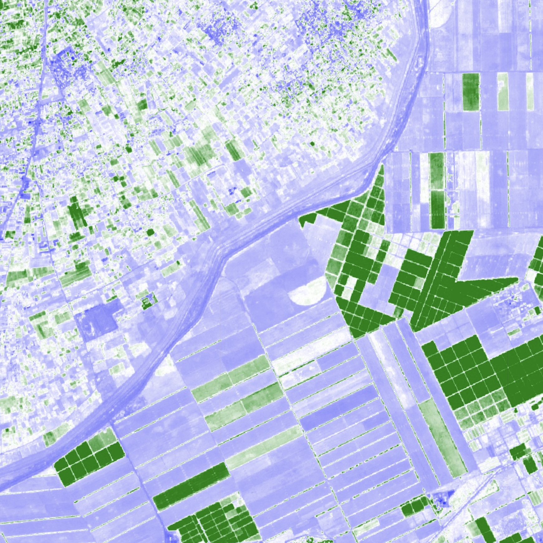
I apply theories of state power and legibility to analyze satellite imagery of a series of study sites (seen to the right) which I argue are illustrative of the phenomenon of strategic borderland agricultural development. Drawing on satellite imagery of these sites, I outline a framework of three landscape patterns which characterize strategic border development: cross-border asymmetries, regularized/rigid geometries, and landscape homogenization. These patterns, I argue, are manifestations the spatial logic of a state with potentially transformative implications for our understanding of territorialization and bordering practices.

Turkey-Syria Border

China-Kazakh Border
Israel-Gaza Border

US-Mexico Border
“From low-earth orbit, you can see continents, islands, the geographical configurations — but you cannot see political boundaries.”
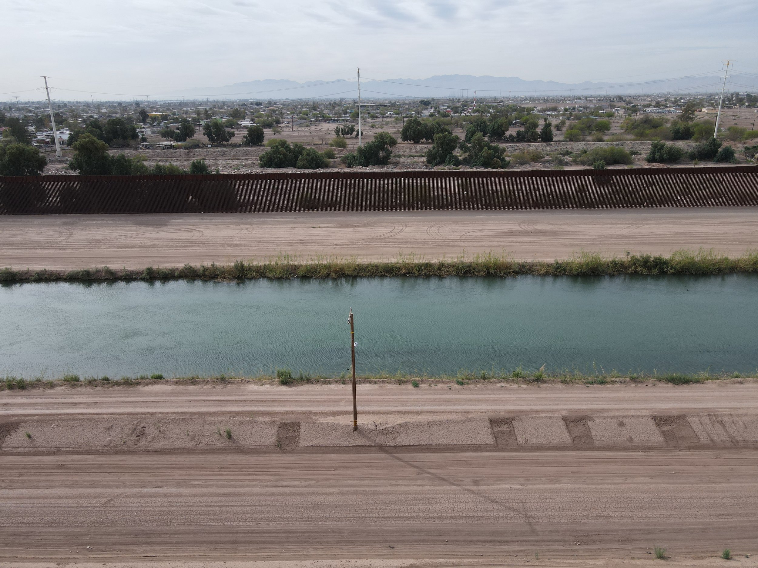
I was recently able to visit one of my sites, the Imperial/Mexicali Valley on the US Mexico border. While there, I was able to photograph the All American Canal, sometimes called the “National Moat”. I have been interested in exploring how this canal serves to both irrigate the intensively farmed Imperial Valley and act as a piece of border infrastructure— almost attempting to naturalize the border in the landscape like a river. I argue this is illustrative of a larger phenomenon of states employing strategic agricultural projects to produce borders in desert and dryland environments.
Agriculture as border production


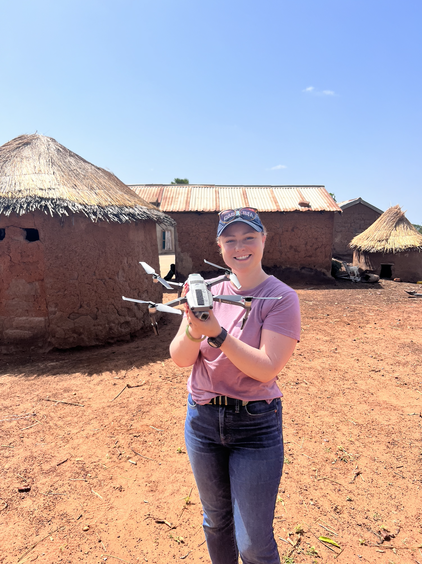
Participatory Drone Mapping of Soil Degradation in West African Drylands
Soil degradation is a widespread and persistent issue in West Africa causing top soil loss, decreasing crop yields, and overall vegetation decline. As degradation is driven by both environmental and social factors, participatory mapping methods are uniquely situated in accessing soil conditions, land management interventions, and fine scale signals of degradation and rehabilitation.
I have worked for four years on a National Science Foundation project titled “Factors Influencing Vegetation Trends in Dryland Zones” (BCS1759064, PI: Dr. Colin T. West).

Publications
6. West, C.T., Saparapa, R., Nomedji, K., Maloney, D. and Moody, A. (2022) “Protocols for Conducting Drone Fieldwork in Togo, West Africa.” Annals of Anthropological Practice, 46 (2), 170-181.
In review, revision, or preparation:
5. Maloney, D. “Military agricultural reclamation: strategic land-use change to remake unruly desert borders” (dissertation chapter, in preparation)
4. Maloney, D., West, C.T., Rojas, A., Moody, A., and GEVAPAF. “Mapping fine-scale land degradation neutrality in Northern Togo: a pilot participatory study using unpiloted aerial vehicles” (submitted, under review)
3. Maloney, D. “Making a desert border: Past, present, and future of strategic land-use change in the Imperial-Mexicali Valley” (dissertation chapter, in preparation).
2. Maloney, D., West, C.T., Rojas, A., Moody, A., and GEVAPAF. “Using UAVs to detect fine-scale signals of land degradation and rehabilitation in West African drylands” (in preparation)
1. Maloney, D., West, C.T., and Moody, A. “Land-use and land-cover change drivers of browning and greening dynamics in Burkina Faso 2000-2018” (in preparation)

ORCID: 0000-0002-6330-2335